
Moselle Valley Map – Regions, Distances and Getting There
This article contains affiliate links to GetYourGuide. If you book through them we may earn a small commission, at no extra cost to you.

The Moselle Valley is easier to understand on a map than the river is to follow: the Moselle twists its way between the Eifel and the Hunsrück hills, from the point where Germany, France and Luxembourg meet down to the Rhine at Koblenz. This is our Moselle Valley map in words and pictures – the regions, the distances between towns and how to get there from the UK and beyond.
Three experiences we recommend
One at each end of the valley and one in the heart of the Terrassenmosel – useful anchor points when you plot your route on the map.
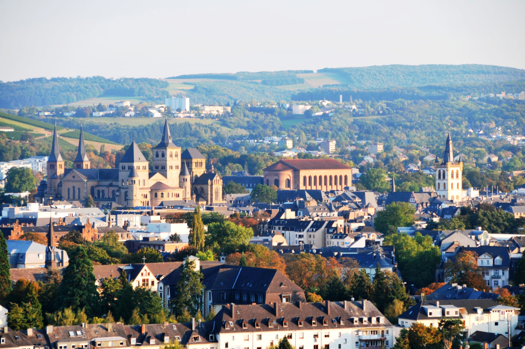 Trier: walking tour with wine tasting
Roman Trier on foot with a guide, tasting Moselle wines along the way – a good start at the southern end of the valley.
Check prices & dates →
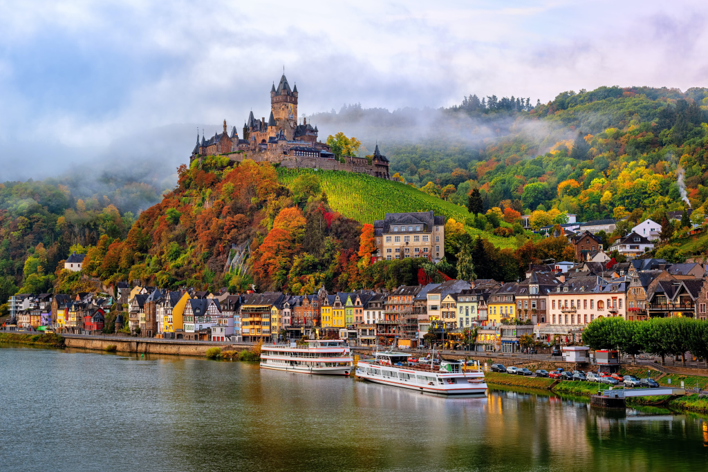 River cruise with lock: Cochem–Beilstein return
See the steep terraced vineyards from the water and pass through a lock on the way to Beilstein – the Terrassenmosel at its most beautiful.
Check prices & dates →
Most booked
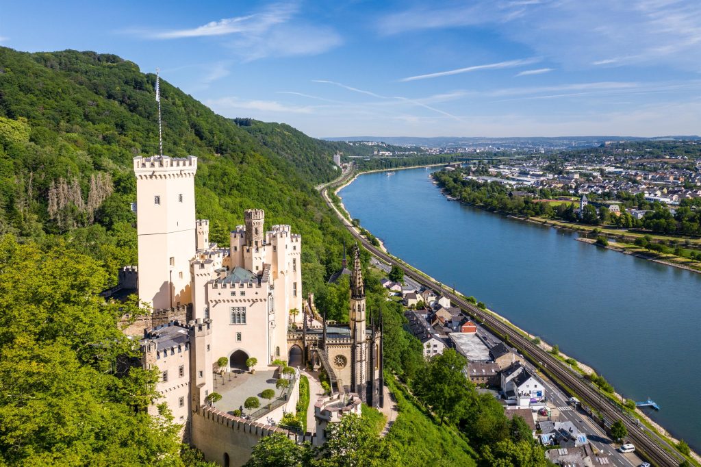 Koblenz: cable car to Ehrenbreitstein
Glide across the Rhine to the fortress – from up there you can see exactly where the Moselle meets the Rhine at the Deutsches Eck.
Check prices & dates →
Where is the Moselle Valley? A quick orientation
When people talk about the Moselle Valley, they almost always mean the German part of the river: the stretch from Perl, where Germany, France and Luxembourg meet, down to Koblenz, where the Moselle flows into the Rhine. All of it lies in western Germany, mainly in the state of Rhineland-Palatinate, and the valley is squeezed between two upland areas: the Eifel to the north and west and the Hunsrück to the south and east.
What makes the map deceptive is the meanders. The Moselle doesn’t run in a straight line from south-west to north-east; it doubles back on itself in tight loops, especially between Trier and Cochem. As the crow flies the valley isn’t particularly long, but if you follow the river – by car, bike or boat – you’ll cover far more ground than an overview map suggests.

The map above shows the main features: Trier in the south near the Luxembourg border, Bernkastel-Kues and Traben-Trarbach in the middle of the valley, Zell and Cochem further downstream and Koblenz on the Rhine. Note, too, Hahn airport up on the Hunsrück plateau – it’s closer to the villages of the Middle Moselle than most people realise.
The course of the Moselle: from the Vosges to the Deutsches Eck
The Moselle is around 544 km (338 miles) long. It rises in France near the Col de Bussang pass in the southern Vosges, at roughly 700 metres above sea level. From there it heads north past Épinal and Toul, curves around the Nancy area and continues through Pont-à-Mousson and Metz towards Thionville.
At Schengen and Perl the river reaches the tri-border point. From there the Moselle forms the border between Luxembourg and Germany until Wasserbillig/Igel, where it becomes entirely German. The German section covers the last 232 km or so (about 144 miles). Along the way the Moselle is joined by several tributaries that have also given their names to wine areas: the Saar at Konz, the Ruwer just downstream of Trier and the Lieser at the village of the same name near Bernkastel-Kues. At the Deutsches Eck in Koblenz the Moselle finally flows into the Rhine.

Want to see the whole course at a glance? Search for “Moseltal” in Google Maps and switch on the terrain layer. You’ll see clearly how the valley cuts down between the Eifel and Hunsrück plateaus – and why the roads sometimes leave the river and take short cuts over the hills.
The regions of the Moselle Valley: Upper, Middle and Terrace Moselle
The German Moselle Valley is usually divided into three main sections. The boundaries vary slightly between sources; the division below follows the state agricultural authority, DLR Rheinland-Pfalz.
Upper Moselle (Obermosel) – Perl to Konz (approx. 41 km)
The uppermost section is broad and open, with gentle slopes and Luxembourg on the opposite bank. Much of the old Elbling grape variety is grown here, and the pace is gentler than further downstream. A good choice if you want flat cycling or plan to combine the Moselle with Luxembourg and Metz.
Saar and Ruwer – the side valleys near Trier
The Saar joins the Moselle at Konz, and the Ruwer just downstream of Trier. Both valleys belong to the Mosel wine region and are known for taut, mineral Riesling. Saarburg is the natural base in the Saar valley; the Ruwer valley is narrow and quiet, with a popular cycle path along an old railway line.
Middle Moselle (Mittelmosel) – Konz to Briedel (approx. 110 km)
This is where the big loops and the steep, south-facing vineyards begin. The Middle Moselle is home to several of the valley’s best-known names: Trier, Neumagen-Dhron, Piesport, Bernkastel-Kues and Traben-Trarbach. It’s also the section with no railway along the river – the train between Trier and Koblenz takes a short cut via Wittlich – so here you’ll be getting around by car, bus, bike or boat.
Terrace Moselle (Terrassenmosel / Lower Moselle) – Briedel to Koblenz (approx. 90 km)
The lower section, often called the Terrassenmosel, has the narrowest stretches and the most dramatic terraced vineyards – among them the Calmont at Bremm, often described as Europe’s steepest vineyard. This is where you’ll find Zell, Beilstein, Cochem and Treis-Karden, with castles such as Burg Eltz hidden above the side valleys. The railway follows the river from Bullay to Koblenz, which makes this part easy to visit without a car.
Distances in the Moselle Valley: driving distance table
The table shows approximate driving distances between the main towns along the fastest route. The figures were calculated with OpenStreetMap-based route planning (OSRM) in October 2026 and rounded; miles are converted and rounded too. In practice journeys often take longer: the valley roads run through villages, and summer weekends bring a lot of traffic.
| Route | Distance (approx.) | Comment |
|---|---|---|
| Koblenz – Cochem | 57 km (35 mi) | Along the river |
| Cochem – Zell | 28 km (17 mi) | Through the Terrassenmosel |
| Zell – Traben-Trarbach | 19 km (12 mi) | Over the hill or round the loop |
| Traben-Trarbach – Bernkastel-Kues | 19 km (12 mi) | Middle Moselle |
| Bernkastel-Kues – Trier | 45 km (28 mi) | Fastest via the motorway, longer along the river |
| Trier – Perl | 45 km (28 mi) | Upper Moselle, Luxembourg border |
| Perl – Metz | 52 km (32 mi) | French Moselle |
| Trier – Luxembourg (city) | 48 km (30 mi) | An easy day-trip combination |
| Cochem – Bernkastel-Kues | 52 km (32 mi) | The fastest route partly crosses the hills |
| Cochem – Trier | 78 km (48 mi) | Via the motorway |
| Koblenz – Trier | 128 km (80 mi) | Via the motorway; much longer along the river |
On some stretches the river is almost twice as long as the road over the hills. If you want to see the valley, follow the B 53 and B 49 close to the water – but allow more time than your sat nav suggests. Most of the larger towns have a bridge, and in several places small car or bike ferries cross the river.
Getting to the Moselle Valley from the UK and beyond
By air: four airports to choose from
The regional tourist board, Mosellandtouristik, names Frankfurt-Hahn, Cologne/Bonn and Luxembourg as the nearest airports, and Frankfurt am Main is a realistic option too – for many international visitors, including those on long-haul flights from North America, it’s the main gateway. Which suits you best depends on where in the valley you’re staying.
| Airport | To Koblenz | To Cochem | To Bernkastel-Kues | To Trier |
|---|---|---|---|---|
| Frankfurt-Hahn (HHN) | – | approx. 40 km (25 mi) | approx. 28 km (17 mi) | approx. 75 km (47 mi) |
| Luxembourg (LUX) | – | approx. 117 km (73 mi) | approx. 84 km (52 mi) | approx. 41 km (25 mi) |
| Cologne/Bonn (CGN) | approx. 95 km (59 mi) | approx. 124 km (77 mi) | approx. 162 km (101 mi) | – |
| Frankfurt am Main (FRA) | approx. 117 km (73 mi) | approx. 159 km (99 mi) | approx. 137 km (85 mi) | approx. 184 km (114 mi) |
- Frankfurt am Main has the widest choice of flights from the UK and further afield and the biggest selection of hire cars. Trains continue towards Koblenz and then along the Moselle; expect at least one change.
- Luxembourg is the most convenient airport for Trier, the Saar and the Upper Moselle – and public transport within Luxembourg is free (except first class) as far as the border.
- Frankfurt-Hahn, despite its name, sits up on the Hunsrück, a stone’s throw from the Middle Moselle. Today it’s served mainly by low-cost airlines flying to southern and eastern Europe, so check whether there’s a route from your airport.
- Cologne/Bonn is a good fit for Koblenz and the Lower Moselle.
By train: Eurostar and onwards
From London, take the Eurostar to Brussels or Paris. Trains link Luxembourg with both Brussels and Trier every hour, so changing in Brussels and Luxembourg is the most direct way into the upper valley. For Koblenz and the Lower Moselle, the high-speed line via Cologne is usually the better bet. Via Paris, a TGV takes around two hours to Luxembourg or roughly 1 hr 25 min to Metz. It makes for a long day, but no car is needed at the other end.
Within the valley, the Moselle line runs Koblenz – Cochem – Bullay – Wittlich – Trier, a branch line (the Moselweinbahn) links Bullay with Traben-Trarbach, and another line follows the Upper Moselle from Trier towards Perl. If you stay at a hotel, guesthouse or winery that takes part in the guest ticket scheme (ÖPNV-Gästeticket), you can often travel free on buses and regional trains during your stay – ask your host when you check in.
By car or motorhome
From the UK, cross the Channel by ferry or Eurotunnel and drive through France or Belgium and Luxembourg – a long day at the wheel that many people split with an overnight stop. A car gives you the most freedom in the valley, but most car parks in Cochem charge a fee and the popular towns get crowded on summer weekends. Remember that you drive on the right. Travelling by motorhome? Our guide to the Moselle by motorhome covers stopovers and tips, and for tents and caravans see our Moselle campsites guide.
By river cruise
Many international visitors first see the valley from the deck of a Rhine–Moselle river cruise. If that appeals, read our guide to a Moselle river cruise before you book.
Maps for cycling, boat trips and walking

A schematic map like the one above goes a long way towards understanding the order of the towns – Saarburg, Trier, Bernkastel-Kues, Traben-Trarbach, Zell, Beilstein and Cochem are strung out like beads on a necklace. For detailed planning there are better tools:
- Tourenplaner Rheinland-Pfalz – the state’s official route planner, with cycling and walking routes, GPX files and elevation profiles.
- visitmosel.de – Mosellandtouristik’s website, where you can also order printed brochures and maps free of charge.
- Mobilitätsatlas – current roadworks, closures and diversions, including on cycle paths.
- Cycle map – every stage of the Mosel-Radweg, the side routes and train information are in our guide to the Moselle cycle route.
Before you book anything, check our guide to the best time to visit the Moselle – and for ideas on what to fill your days with, see things to do in the Moselle Valley.
How to use the map when planning your trip
- Choose your base by region. Trier for the Upper Moselle, Saar and Ruwer; Bernkastel-Kues or Traben-Trarbach for the Middle Moselle; Zell or Cochem for the Terrassenmosel. Koblenz works well if you want to combine the trip with the Rhine.
- Think river, not crow. 20 km on the map can easily become 40 km along the water.
- Check the rail map. There’s no railway along the river between Bullay and Trier – without a car, your options there are bus, bike and boat.
- Mix your transport. Cycle downstream and take the train or boat back, or ride a boat one way and walk home.
- Fly in and out of different airports. Landing in Frankfurt and leaving from Luxembourg (or the other way round) saves you doubling back along the valley.
Moselle Valley map: frequently asked questions
Where is the Moselle Valley in Germany?
In western Germany, mainly in the state of Rhineland-Palatinate. The German section runs from Perl on the border with France and Luxembourg to Koblenz, where the Moselle flows into the Rhine. The valley lies between the Eifel and Hunsrück uplands.
How long is the Moselle?
Around 544 km (338 miles) from its source near the Col de Bussang in the Vosges to its mouth at Koblenz. The last 232 km or so count as the German section.
Which airport is closest to the Moselle Valley?
Frankfurt-Hahn is closest to the Middle Moselle (approx. 28 km to Bernkastel-Kues), Luxembourg is closest to Trier (approx. 41 km) and Cologne/Bonn is closest to Koblenz. Frankfurt am Main has the most flights from the UK and further afield but is further away.
How far is it from Cochem to Bernkastel-Kues?
About 52 km (32 miles) by car on the fastest route. If you follow the river all the way it’s longer and takes considerably more time. By bike on the Mosel-Radweg it’s around 78 km.
Can you travel the whole Moselle Valley by train?
Not along the whole river. The Moselle line runs Koblenz–Cochem–Bullay and then via Wittlich to Trier, so towns such as Bernkastel-Kues and Piesport have no railway. There you’ll need a bus, a bike or a boat.
Where can I find a good map of the Moselle Valley?
For an overview, Google Maps in terrain mode is enough. For cycling and walking, Tourenplaner Rheinland-Pfalz and visitmosel.de are the best sources, and printed maps can be ordered free of charge from Mosellandtouristik.
- DLR Rheinland-Pfalz – Moselabschnitte – length of the river, source, length of the German section and the Obermosel/Mittelmosel/Untermosel division with kilometres
- Mosellandtouristik – Anreise & Mobilität – nearest airports and the guest ticket (ÖPNV-Gästeticket)
- Frankfurt-Hahn Airport – airlines and destinations (October 2026)
- Luxembourg.public.lu – public transport – free public transport (except first class), hourly trains to Trier, Metz and Brussels, TGV to Paris in around two hours
- Inspire Metz – 2026 press kit – Paris–Metz journey time by TGV (1 hr 25)
- Radwanderland Rheinland-Pfalz – Mosel-Radweg fact sheet – railway lines in the valley (Moselstrecke, Moselweinbahn, Obermoselstrecke) and tributaries
- OSRM / OpenStreetMap – calculated driving distances (October 2026)
- Tourenplaner Rheinland-Pfalz and Mobilitätsatlas – mapping tools
Last updated: October 2026. Facts checked against the sources above; prices and opening hours may change.